Épaule du Marboré
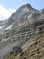
Épaule du Marboré is a pyrenean summit, culminating at 3,073 m (10,082 ft) in the Monte Perdido Range, marking the Franco-Spanish border. It lies on the Greenwich meridien.
Read article


Top Questions
AI generatedMore questions
Nearby Places
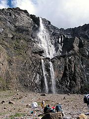
Gavarnie Falls
Waterfall in Hautes-Pyrénées

Cirque de Gavarnie
Cirque in southwestern France

Cilindro de Marboré
Mountain in Spain

Pyrénées – Mont Perdu World Heritage Site
UNESCO World Heritage Site in Spain and France

Pic de Marboré
Casque du Marboré

Tour du Marboré

Cascade Peaks
Three mountain summits in the Pyrenees